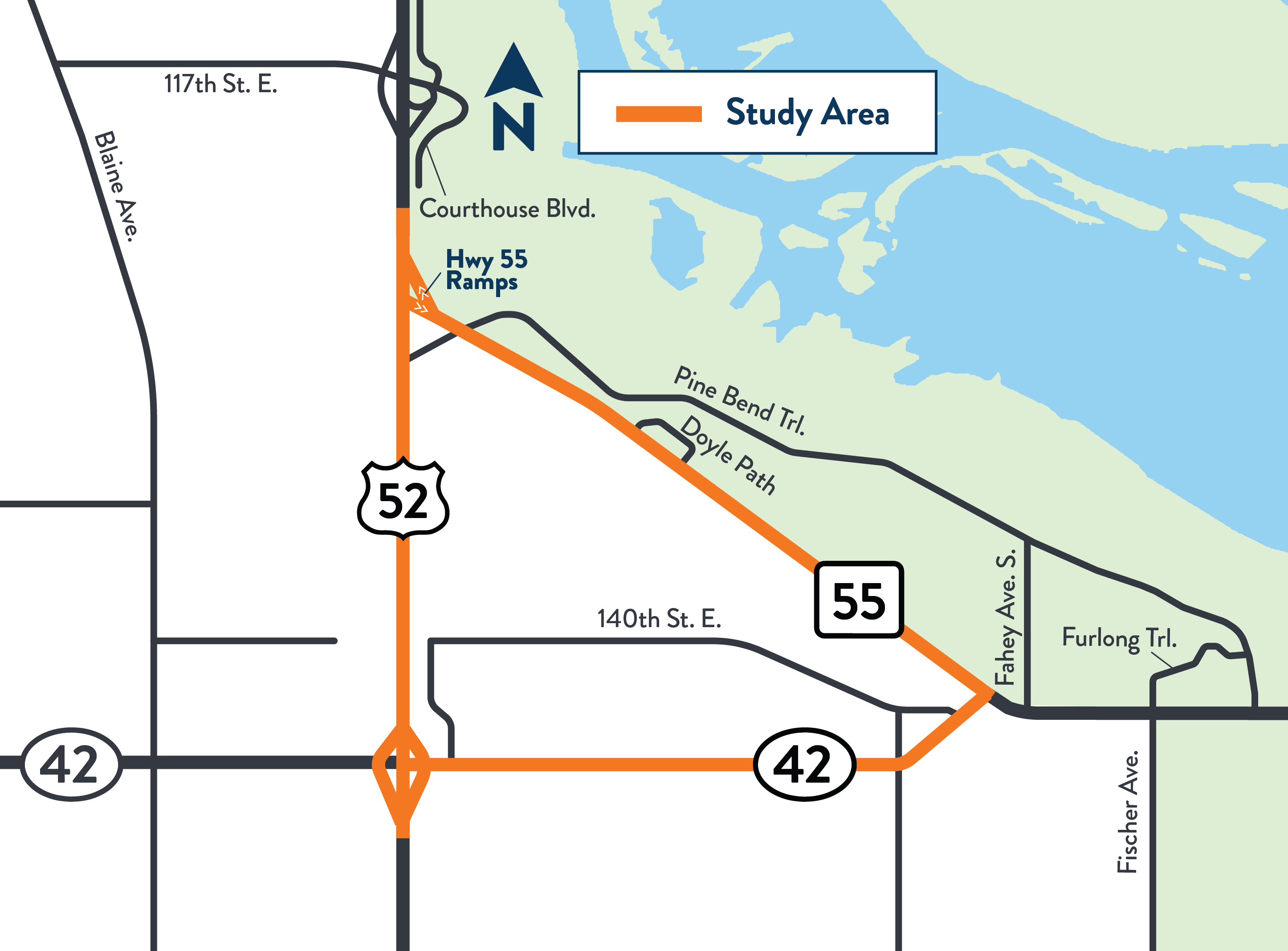
We are studying the Hwy 52, Hwy 55 and Co. Rd. 42 triangle in Rosemount and Inver Grove Heights.
The purpose of this study is to build upon previous transportation studies completed by us and Dakota County to reflect current and future transportation needs of Hwy 52, Hwy 55, and Co. Rd. 42. We completed the first part of this study in 2025. The second part of the study is anticipated to be complete in 2027.
Through our initial engagement, the following improvements were recommended:
Realign Hwy 55 to Co. Rd. 42
Remove southbound Hwy 52 to the Hwy 55 bridge and remove the northbound Hwy 55 to Hwy 52 ramp
Expand realigned Hwy 55/Co. Rd. 42 to a 4-lane divided road between Hwy 52 and east of Fahey Ave.
Add southwest and southeast loops to Hwy 52/Co. Rd. 42 interchange
Shift Hwy 52 to the west to provide room for Courthouse Blvd. connection
Extend Courthouse Blvd. from Hwy 55 to 117th St. interchange to the north
We've also examined the realignment of Hwy 55 to an east/west corridor along the existing Co. Rd. 42 right-of-way and identified possible jurisdictional and funding shifts between MnDOT, Dakota County, and the city of Rosemount to minimize impacts, promote long-term sustainability, and prioritize available funding.
Summary of work
Collect information on issues and opportunities
Engage with specific businesses and property owners as well as government stakeholders
Gather safety concerns from residents and business owners
Next steps
We will continue to build on the recommendations from part one of the study, with additional public outreach and engagement in the second part of the study. The second part of this study is anticipated to be complete in 2027 and will extend the study limits east on Hwy 55 to the existing 4-lane divided road in Hastings.
Anticipated upcoming projects that will build on the study include:
2032-2033 Co. Rd. 42 corridor expansion
2034-2035 Hwy 52 pavement and loops construction
2035-2036 Hwy 52/Courthouse Blvd. and Hwy 55 improvements
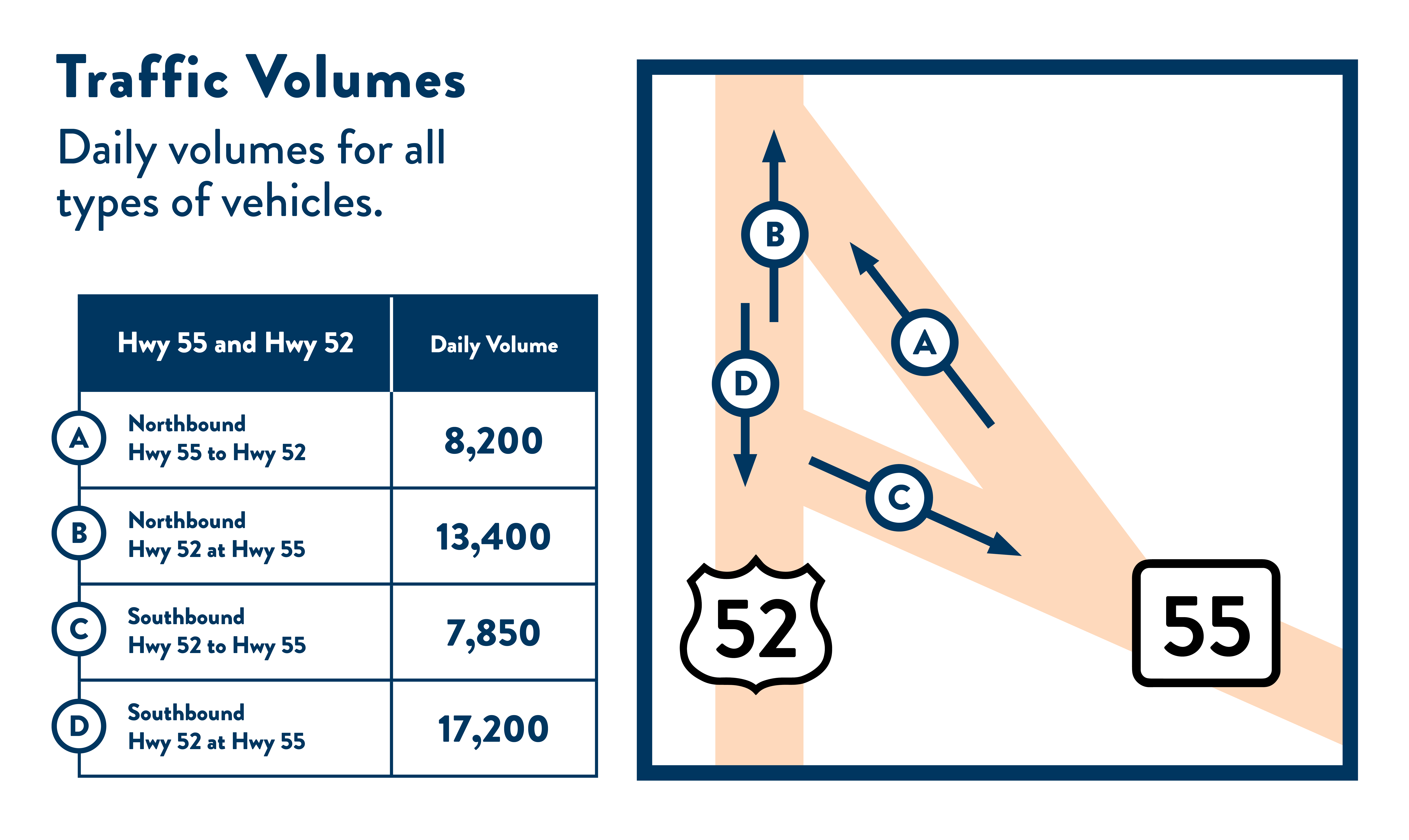
Traffic volumes
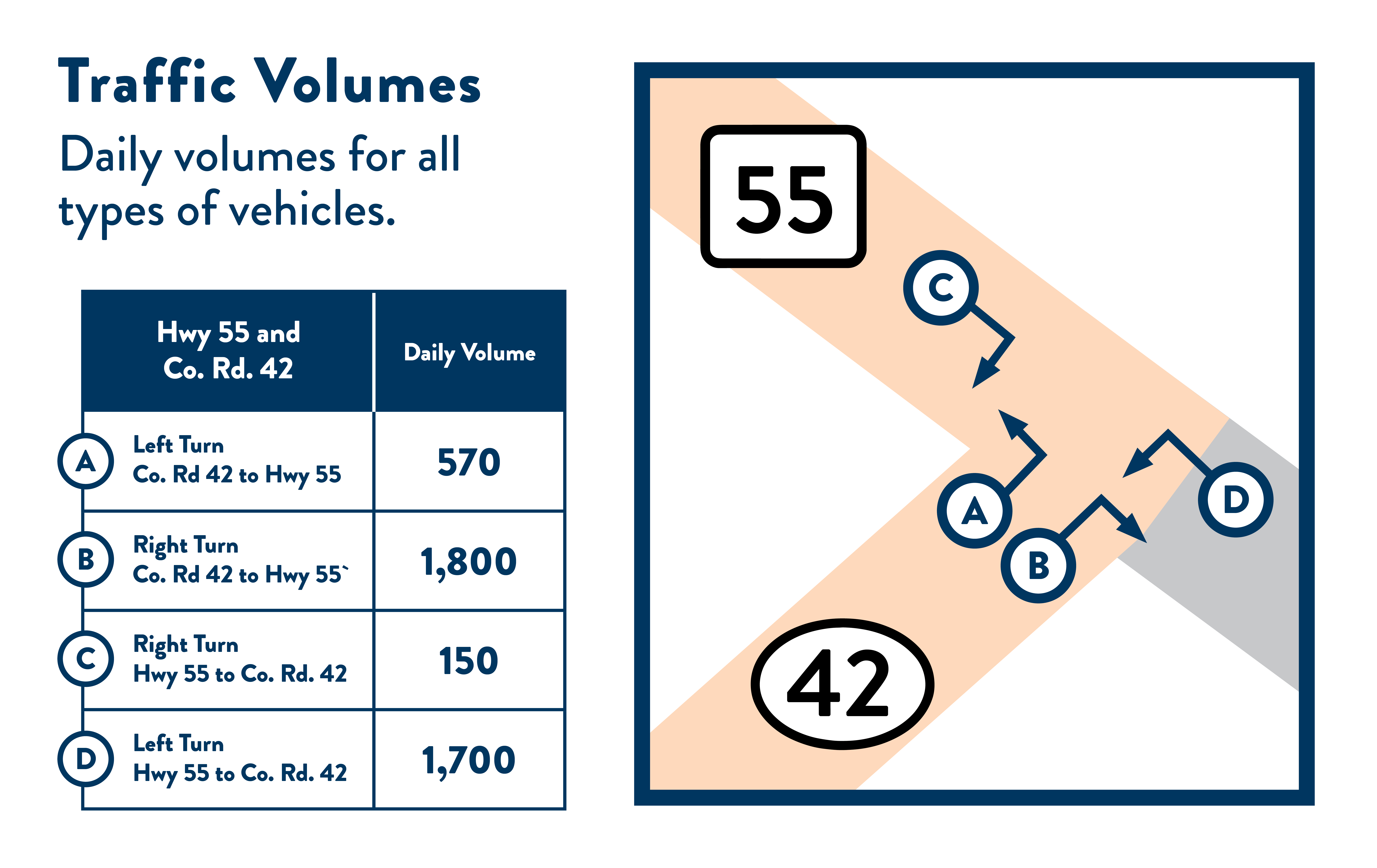
A traffic analysis was conducted in 2022-2023 of the Hwy 52 and Hwy 55 interchanges, as well as the Hwy 55 and Co. Rd. 42 interchanges.
Hwy 55 and Hwy 52 daily volumes for all types of vehicles
Traffic volumes for Hwy 55/Co. Rd. 42 are as follows:
Left turn Co. Rd. 42 to Hwy 55 (A): 570 vehicles daily
Right turn Co. Rd. 42 to Hwy 55 (B): 1,800 vehicles daily
Right turn Hwy 55 to C. Rd. 42 (C): 150 vehicles daily
Left turn Hwy 55 to Co. Rd. 42 (D): 1,700 vehicles daily
Heavy Truck Traffic Volumes
All the roadways in the study have a high truck percentage ranging from 4-31% with more than 3,000 daily trucks using Hwy 52, more than 550 daily trucks using Hwy 55, and more than 200 daily trucks using Co. Rd. 42.
Heavy vehicles are:
Slower to accelerate and stop.
Slower to react to hazards in roadway.
More difficult to merge onto a high-speed corridor, especially without acceleration lanes.
Contributing to slowdowns, impacting travel times for other roadway users.
Seasonal Traffic:
Daily traffic increased from 25,000 during winter months to 40,000 during summer months.
Traffic Destinations:
On Hwy 52, the majority of trips are long-distance with Rochester, Minneapolis-Stain Paul, or beyond as destinations.
Crash data was collected within the study area from 2018-2022
Highest study area crash types:
35% single vehicle run off road
27% rear end crashes
14% sideswipe same direction
12% right angle
Fatal crash:
A rear end crash on Hwy 55, west of Doyle Path, involved a heavy vehicle and inclement weather.
Speed:
Hwy 55 within the study area shows a large speed distribution with non-peak traffic going 5-8 MPH over the speed limit and peak traffic being 5-10 MPH under the speed limit on average due to congestion.
The number of intersections, public driveways, and private driveways along the study roadways are: